
When you look at a map of Namibia, its shape is instantly recognisable – a bulky, square-shouldered figure on the south-western corner of Africa, crowned by the narrow Caprivi Strip. This familiar outline, however, is not an accident of nature. It is a story written by colonial history.
Namibia is a country of immense scale. Covering just over 824,000 square kilometres, it ranks among the largest and most sparsely populated countries in the world. To put this into perspective, Namibia is roughly four times the size of the United Kingdom, yet home to just over three million people.
It is a land of defined by vast distances, spanning roughly 1,440 kilometres at its widest point, while its Atlantic coastline stretches for more than 1,500 kilometres, from the mouth of the Kunene River in the north to the Orange River in the south.
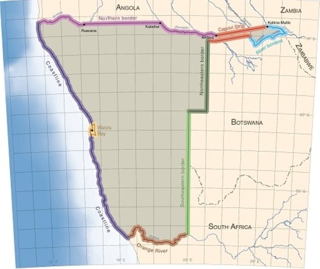
The International Boundary of Namibia. Image: Atlas of Namibia
Access Sought, Reality Found
Namibia’s unusual outline, particularly the long, narrow “panhandle” of the Zambezi Region (formerly Caprivi Strip), is the product of history as much as geography. During the late 19th-century scramble for Africa, Germany claimed what became known as German South West Africa. The colony’s borders were drawn through a series of treaties with Britain and Portugal, the dominant colonial powers in neighbouring territories.
The Caprivi Strip was added in 1890 to give Germany access to the Zambezi River. The intention was to establish a trade route to the Indian Ocean and link German South West Africa with German East Africa (present-day Tanzania). In practice, this ambition proved futile, as Victoria Falls rendered the Zambezi unnavigable. Nevertheless, the narrow extension, approximately 450 kilometres long, remains one of Namibia’s most distinctive geopolitical features. It provides the country with a border with Zambia and places it at the heart of the Kavango–Zambezi (KAZA) Transfrontier Conservation Area, the world’s largest conservation landscape.
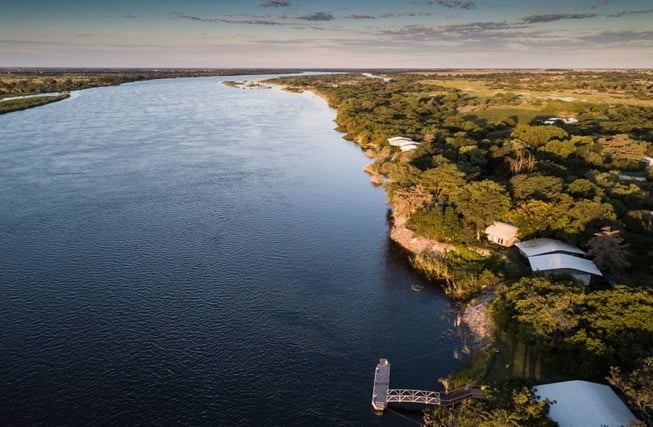
Birdseye view of the Zambezi River. Image: GüntherLenz
Natural Borders and Negotiated Lines
Elsewhere, Namibia’s borders largely follow a combination of natural landmarks and straight colonial lines. The Orange River defines the southern boundary, while the Kunene and Okavango Rivers shape parts of the northern frontier. Much of the country’s southern and central borders, however, were drawn by European negotiating rooms. The border with South Africa, for example, was largely formalised through the 1890 German–British agreement, using lines of longitude and latitude that paid little attention to existing communities, cultures, or ecosystems.
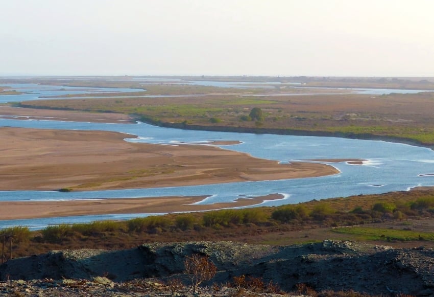
The Orange River defines the southern boundary between Namibia and South Africa
Today, Namibia’s distinctive shape stands as a lasting reminder of how distant political decisions continue to influence the physical and cultural landscapes of Africa – long after the colonial era has passed.
For more on Namibia and its great wonders visit the Atlas of Namibia website.

SUBMIT YOUR COMMENT